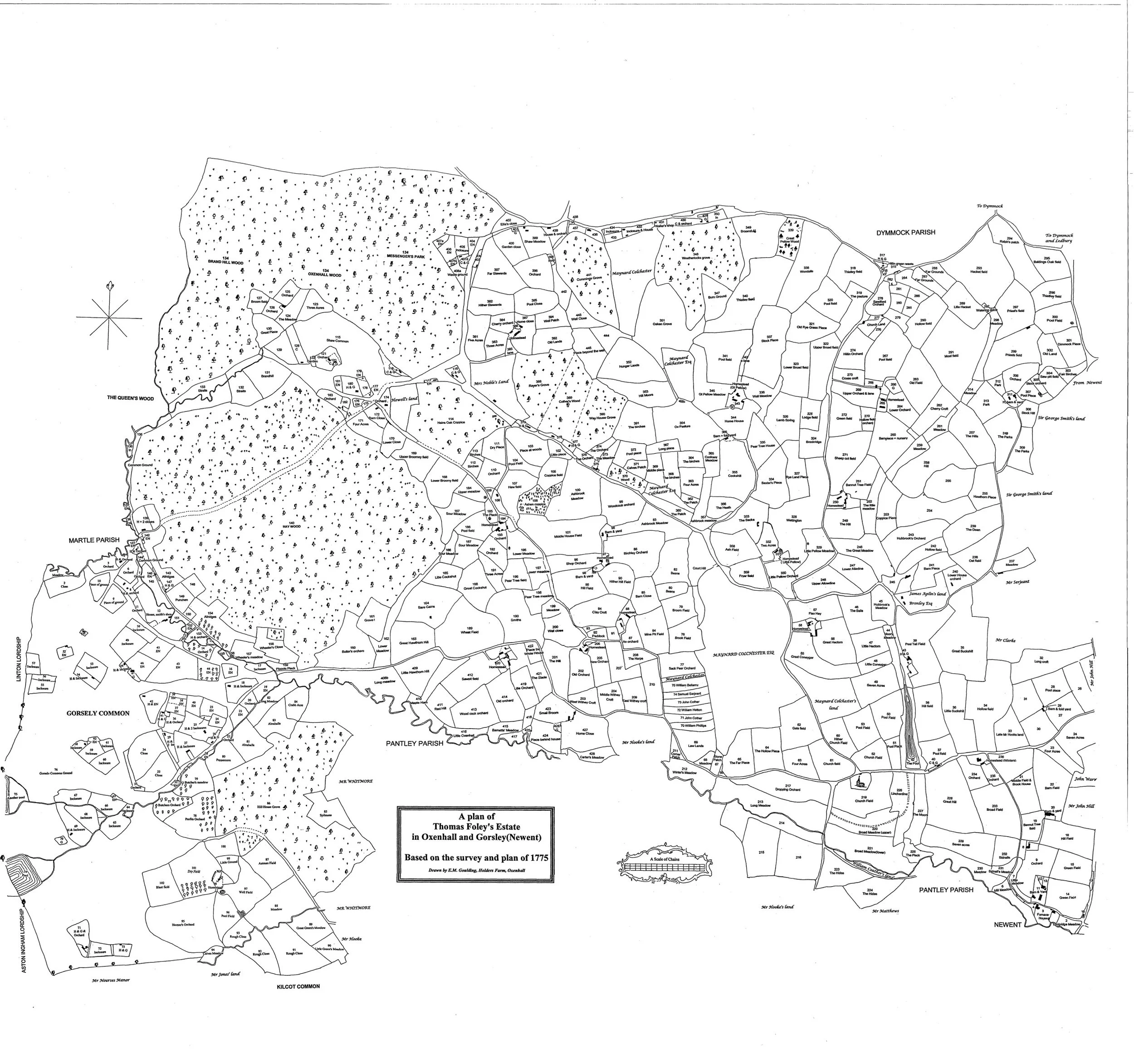
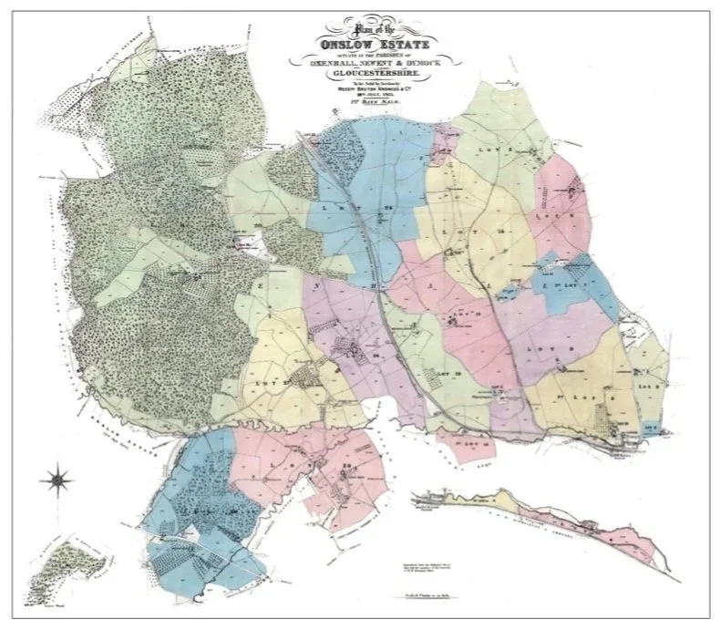
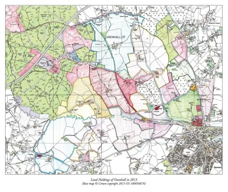
Oxenhall Maps

The Foley Estate 1775

Black and white map titled 'A plan of Thomas Foley's Estate in Oxenhall and Gorsley (Newent) based on the survey and plan of 1775' showing detailed property divisions, roads, forests, and parish boundaries in rural England.

The Onslow Estate 1913

Color-coded map of Onslow Estate in Gloucestershire, showing boundaries, roads, and land divisions.

Landholdings of Oxenhall 2013

Map showing land holdings of Oxenhall in 2013 with different land areas color-coded, including green, pink, yellow, and purple, along with roads, water features, and the village of Newent in the bottom right corner.